Arc of Statehood
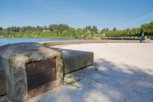
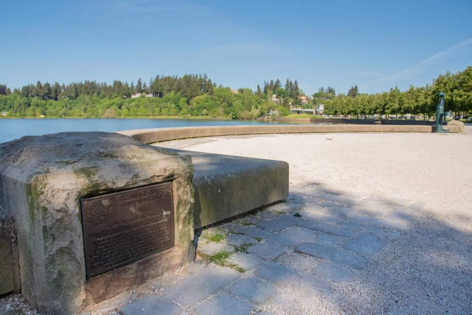
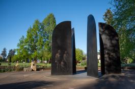
The Arc of Statehood is made of 39 bronze markers on stone blocks lining the pedestrian pathway that curves around Capitol Lake.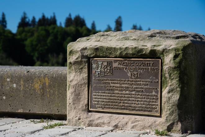
Facts
About the Arc of Statehood
The 39 bronze markers are for each county in the state of Washington. Markers are arranged alphabetically beginning at the south end of the arc with Adams County and ending at the arc's north end with Yakima County.
County inscriptions
Each marker has a map showing the location of the county and a short paragraph about the county seat, name origin, date founded, important features and history, and tribal names of the Native American people native to its borders.
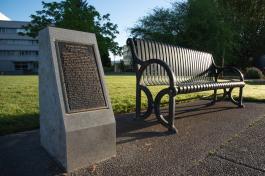
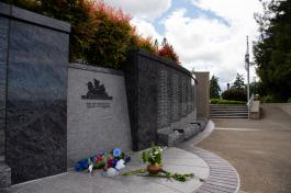
In 2001, time capsules for 10 counties were sealed and buried on the Eastern Washington Butte at the north end of the Arc, to be opened in 2051. In 2002, an interpretive sign about the county markers was added at the crosswalk near the corner of 5th Avenue and Simmons Street.
The county markers project was conceived and promoted by the North Capitol Campus Heritage Park Development Association. The markers were fabricated and installed in 2002 with the additional support of the Thurston County Board of Commissioners, the General Federation of Women’s Clubs, the Washington Association of Former County Elected Officials, and numerous private and public donors.
The markers have weathered inconsistently leading to some loss of legibility, but overall they continue to be in good condition. The markers and the stones are gently pressure-washed annually.
Read the inscription for each county below.
- Adams County inscription
-
ADAMS COUNTY
1883
County Seat: Ritzville
Named for John Adams, second President of the United States.
Like many eastern Washington counties, Adams County was built on a foundation of railroads and wheat. Native grasslands had turned into wheat fields all across eastern Washington by the late 1800s. Horses hauled the wheat to town and steam-powered freight trains carried it off to the waiting world. The Columbia Basin Project of the early 1950s brought irrigation to western Adams County, turning parched sagebrush desert into alfalfa fields, orchards and farms. - Asotin County inscription
-
ASOTIN COUNTY
1883
County Seat: Asotin
Name derived from “Ha-Shu-tin”, the Nez Perce Indian name for Asotin Creek, translated as “eel stream.”
Traditional home of Nez Perce American Indian people.
Bordered by Oregon on the south and Idaho on the east, Asotin County lies in the extreme southeast corner of Washington. The Snake River cuts a canyon nearly 2,000 feet deep along its eastern side. Outside settlers started arriving during the 1860s, spurred by a gold rush in Idaho. But pioneer farmers soon found greater fortune in raising beef cattle and wheat. - Benton County inscription
-
BENTON COUNTY
1905
County Seat: Prosser
Named for Thomas Hart Benton, U.S. Senator from Missouri who championed new federal laws in the 1850s and '60s that opened up homesteading in the west.
Traditional home of Klickitat, Yakama, Wanapum, Umatilla, Nez Perce, Walla Walla, Palouse and Cayuse American Indian people.
Benton County is known for its dry, sunny climate and for one of America’s last wild, free-flowing reaches of the mighty Columbia River. In 1943 the U.S. Government chose Benton County as a top-secret site for development of the atomic weapons deployed at the close of World War II. It is also home to the Washington State University Irrigated Agricultural Research and Extension Center. - Chelan County inscription
-
CHELAN COUNTY
1899
County Seat: Wenatchee
Name derived from a Salish Indian language word meaning “deep water,” a reference to Lake Chelan.
Traditional home of Chelan, Entiat, Methow and Wenatchi American Indian people.
Chelan County stretches from the eastern slopes of the Cascade Range to the wide Columbia River. Its key geographical feature is fjord-like Lake Chelan, a deep glacial lake that snakes through the mountains for more than 55 miles. When agricultural irrigation arrived in the early 1900s, this part of central Washington became one of the largest apple-producing regions in the world. Chelan County was the site of the first vehicle bridge (1908) and the first hydroelectric dam (1931) to span the U.S. portion of the Columbia River. - Clallam County inscription
-
CLALLAM COUNTY
1854
County Seat: Port Angeles
Named for the Klallam Indian people Traditional home of Hoh, Jamestown S’Klallam, Lower Elwha Klallam, Makah, Quileute and Quinault American Indian people.
Clallam County is located in the farthest northwest corner of the continental United States, framed by the Strait of Juan de Fuca and the great Pacific Ocean. It is a land wild coastline, deep forest and rugged Olympic Mountains that rise up to 8,000 feet high. Because of its geographic isolation, this region is home to animal species—Olympic marmot, Crescenti trout and magnificent Roosevelt Elk—native to no other part of the world. - Clark County inscription
-
CLARK COUNTY
1849
County Seat: Vancouver
Named for Captain William Clark of the Lewis and Clark Expedition, sent to explore the Northwest for the United States in 1803-06.
Traditional home of Chinook and associated Salish-language tribes, including Klickitat and Cowlitz American Indian people.
Clark County, set inside a major curve of the mighty Columbia River, lies in the extreme southwest corner of Washington. One of the state’s oldest counties— with boundaries set as early as 1845—it proudly regards itself as “the cradle of the Pacific Northwest.” In 1825 the British Hudson’s Bay Company established a fur-trading post at Fort Vancouver, setting the stage for frontier settlement north of the Columbia. - Colombia County inscription
-
COLUMBIA COUNTY
1875
County Seat: Dayton
Since the Columbia River never comes within 40 miles of Columbia County, the origin of this county’s name remains a historical puzzle.
Traditional home of Cayuse, Umatilla and Walla Walla American Indian people.
In the southern Columbia County, golden wheatfields give way to the forested ridges and peaks of the rugged Blue Mountains. The county seat of Dayton began as a stop on a stagecoach route that followed an older Indian trail across southeast Washington. The Columbia County Courthouse, built in 1887, is the oldest functioning courthouse in the state. - Cowlitz County inscription
-
COWLITZ COUNTY
1854
County Seat: Kelso
Named for the Cowlitz Indian people and for the Cowlitz River.
Traditional home of the Lower Cowlitz American Indian people Cowlitz County has always served as a major travel corridor.
The Cowlitz River, running north-and-south through the county, was a vital transportation route for local Indians, early fur traders and American pioneer settlers headed for Puget Sound. Wagon roads and steamboat routes led through Cowlitz County, followed by the region’s first major railroad and later its first major interstate highway. It was on the banks of the Cowlitz that settlers met in 1852 to petition Congress for the creation of a new territory—eventually called Washington— north of the Columbia River. - Douglas County inscription
-
DOUGLAS COUNTY
1883
County Seat: Waterville
Named for American statesman Stephen A. Douglas, ardent supporter of U.S. westward expansion.
Traditional home of Moses-Columbia, Wenatchi, Methow, Entiat, Chelan, Okanogan, San Poil and Nespelem American Indian people.
Tucked into a magnificent curve of the great Columbia River, this county in the heart of the state is known as Big Bend Country. Sculpted canyons and coulees tell of the fiery lava flows and massive Ice Age floods that shaped the Columbia Plateau. - Ferry County inscription
-
FERRY COUNTY
1899
County Seat: Republic
Named for Elisha P. Ferry, governor of Washington at the time of statehood in 1889.
Traditional home of San Poil, Nespelem, SweelPoo and Lakes American Indian people.
Ferry County lies in the Okanogan Highlands, threaded with river valleys and crowned by the ridges and peaks of the Kettle River Range. The earliest outside settlers came searching for gold in the 1890s. Homesteaders, ranchers and timber cutters followed a few years later. The county was originally carved from land set aside in 1872 for the Confederated Tribes of the Colville Reservation. The southern portion of Ferry County remains reservation land, home to members of a dozen distinct eastern Washington tribes. - Franklin County inscription
-
FRANKLIN COUNTY
1883
County Seat: Pasco
Named for American statesman Benjamin Franklin.
Traditional home of Yakama, Wanapum, Walla Walla, Cayuse, Umatilla and Nez Perce American Indian people.
Franklin County is bordered by two great historic rivers: the Columbia River on the west and the Snake River on the east. The county’s first outside settlers were cattle ranchers who came in the 1860s. Sheep herders and farmers soon followed. In 1879 the Northern Pacific Railway chose to complete its transcontinental line by building northwest from Pasco through the mountains to Puget Sound, paving the way for further Washington settlement and growth. - Garfield County inscription
-
GARFIELD COUNTY
1881
County Seat: Pomeroy
Named for James A. Garfield, 20th President of the United States, in the year he was assassinated.
Traditional hunting and gathering grounds of Nez Perce American Indian people.
Garfield County, a land of farm fields and pastures, is bounded on the north by the scenic Snake River and on the south by the wild Blue Mountains. Explorers Lewis and Clark passed through here on their homeward journey in 1806, traveling along an American Indian route known as the Nez Perce Trail. Heated disagreement in the county’s early days over which town should serve as county seat was resolved by an unusual Act of Congress that gave the honor to Pomeroy. - Grant County inscription
-
GRANT COUNTY
1909
County Seat: Ephrata
Named for Ulysses S. Grant, 18th President of the United States.
Traditional home of Moses-Columbia and Wanapum American Indian people.
Dramatic desert canyons and cliffs, carved by staggering Ice Age floods, mix with clear lakes and reservoirs in wide-open, sunny Grant County. Massive Grand Coulee Dam—built in the 1930s in the county’s northeastern corner— brought agricultural irrigation to central Washington, turning desert land into farms. - Grays Harbor County inscription
-
GRAYS HARBOR COUNTY
1854
County Seat: Montesano
Originally known as Chehalis County, Grays Harbor was renamed in 1915 to honor its sheltered saltwater bay. Captain Robert Gray was the first U.S. navigator to explore the Northwest coast, sailing into Grays Harbor in 1792.
Traditional home of Lower Chehalis, Upper Chehalis and Quinault American Indian people.
Ocean beaches, timbered foothills and a dozen major rivers are all found in Grays Harbor County, located at the base of the Olympic Peninsula. At the turn of the 20th century, immigrants from all over the world flocked to Grays Harbor to work in its deep woods and tidewater sawmills. The world’s first tree farm was founded in Grays Harbor County in 1941. - Island County inscription
-
ISLAND COUNTY
1853
County Seat: Coupeville
Named for the five Puget Sound islands that comprise the county.
Traditional home of Skagit, Snohomish, Klallam and Swinomish Native American People.
Island County consists of Whidbey, Camano, Smith’s, Deception and Ure’s Islands in the northern Puget Sound. In pioneer days the two largest of these, Whidbey and Camano, were important hubs of the lumber trade. Whidbey Island’s historic Fort Casey was one of three army outposts built to guard the entrance to Puget Sound at the end of the 19th century. Today the same island is home to Whidbey Naval Air Station, which opened in 1942 at the height of World War II. - Jefferson County inscription
-
JEFFERSON COUNTY
1852
County Seat: Port Townsend
Named for Thomas Jefferson, third President of the United States.
Traditional home of Chimakum, Hoh, Klallam, Quilcene, Quileute and Quinault American Indian people.
Jefferson County stretches from shore to shore across the Olympic Peninsula, embracing the highest peaks of the Olympic Range. Three rare temperate rain forests—groves of towering cedar and hemlock laden with lichen and moss— stand within the boundaries of Olympic National Park. From 1854 to 1911 the county seat of Port Townsend served as the port of entry for ships on Puget Sound. Its well-preserved historic districts still capture the exuberant spirit of Washington’s early years. - King County inscription
-
KING COUNTY
1852
County Seat: Seattle
Named for William Rufus Devane King, who was elected vice president of the U.S. just two days before the county was created. In 1986 King County was officially renamed in honor of American civil rights leader Dr. Martin Luther King, Jr.
Traditional home of Duwamish, Muckleshoot, Snoqualmie, Puyallup, Suquamish and Tulalip American Indian people.
King County, population hub of the Puget Sound corridor, reaches from the crest of the Cascade Mountains to the beaches of Vashon and Maury Islands. Its pioneer lumber mills, coal mines and farms gave way in the 20th century to aerospace, manufacturing and high technology. King County is also home to the University of Washington, established by the territorial legislature in 1861. - Kitsap County inscription
-
KITSAP COUNTY
1857
County Seat: Port Orchard
Originally called Slaughter County after Lt. William A. Slaughter, who was killed in the Puget Sound Indian War of 1855-56. The name was soon changed to honor a Suquamish Indian leader who had courteously received early English explorers.
Traditional home of Suquamish and S’Klallam American Indian people.
Located at the very heart of the Puget Sound, Kitsap County encompasses Bainbridge Island, Blake Island and the Kitsap Peninsula. Busy pioneer sawmills, fed by huge Northwest trees, once made this the richest county per capita in the United States. In 1891 the federal government commissioned a shipyard at Bremerton, ushering in a long-term Navy presence in Kitsap County. - Kittitas County inscription
-
KITTITAS COUNTY
1883
County Seat: Ellensburg
Named for the Kittitas (Upper Yakama) Indian people.
Traditional hunting and gathering grounds of several bands and tribes now associated with the Yakama Nation.
Kittitas County stretches from the forested flanks of the Cascade Range to sagebrush hills overlooking the mighty Columbia River. In between these two extremes lies the irrigated farmland of the beautiful Kittitas Valley. Though the county seat of Ellensburg once dreamed of becoming Washington’s state capitol, those hopes were dashed by a fire that swept through the center of town in 1889. Ellensburg was chosen instead in 1891 as the site of a state-funded normal school for training classroom teachers, a college that later grew into Central Washington University. - Klickitat County inscription
-
KLICKITAT COUNTY
1850
County Seat: Goldendale
Named for the Klickitat people and the rushing Klickitat River that flows from the county’s heart.
Traditional home of Klickitat, Wishram, White Salmon and Yakama American Indian people.
Klickitat County rolls along 84 miles of the scenic Columbia Gorge, from the forested slopes of the Cascade Range to the golden, sun-baked hills of central Washington. Before outside settlers arrived, Indian people from up and down the Columbia River river gathered at the village of Wakemap (now flooded behind The Dalles dam) for fabulous trading fairs. Native pictographs and petroglyphs can still be seen on the timeless cliffs of the stunning river gorge. - Lewis County inscription
-
LEWIS COUNTY
1845
County Seat: Chehalis
Named for Meriwether Lewis of the Lewis and Clark Expedition, sent to explore the Northwest for the United States in 1803-06.
Traditional home of Salish-speaking Upper Chehalis, Upper Cowlitz and Lower Cowlitz American Indian people.
In 1838 the agricultural arm of the Hudson’s Bay Company established a large farm on Cowlitz Prairie near the present town of Toledo—in part to attract British settlers to the Pacific Northwest. But soon Americans were streaming westward across the Oregon Trail and challenging Britain’s claim to what is now Washington. Lewis County is home to one of the oldest surviving American pioneer homes in the state, a peeled-log cabin built by settlers John and Matilda Jackson in 1845. - Lincoln County inscription
-
LINCOLN COUNTY
1883
County Seat: Davenport
Named for Abraham Lincoln, 16th President of the United States.
Traditional home of Moses-Columbia, Spokane, San Poil, SweelPoo and Nespelem American Indian People.
Lincoln County offers a classic eastern Washington landscape of golden wheatfields, green pine forest and dramatic basalt cliffs. In the late 1800s, waves of ethnic Germans immigrating from Russia settled on farms across Lincoln and neighboring counties. - Mason County inscription
-
MASON COUNTY
1854
County Seat: Shelton
Originally called called “Sawamish” after a local band of Squaxin Island Indians. It was renamed in 1864 in honor of Charles H. Mason, first Secretary of Washington Territory.
Traditional home of Skokomish and Squaxin Island American Indian people.
Mason County, historically rich in timber and shellfish, extends from the wild Olympic Mountains to the inlets of Puget Sound. Along the edge of narrow, hook-shaped saltwater Hood Canal runs one of the most scenic shoreline drives in all of Washington. - Okanogan County inscription
-
OKANOGAN COUNTY
1888
County Seat: Okanogan
Named for the Okanogan Indian people.
Traditional home or range of American Indian tribes now associated with the Confederated Tribes of the Colville Reservation.
Fur traders came to the Okanogan region as early 1811, attracted by Northwest beaver pelts that could be sold for a fortune in China. Monumental cattle drives along the famous Cariboo Trail during the mid-1800s supplied fresh beef to gold rush towns across the Canadian border. Two decades later gold was discovered in the Okanogan as well. Early irrigation schemes transformed the Okanogan Valley into a land of green orchards. Homesteading continued here well into the 20th century, earning this county its title of “Washington’s Last Frontier.” - Pacific County inscription
-
PACIFIC COUNTY
1851
County Seat: South Bend
Named for the county’s location on the Pacific coastline—the only U.S. county named for the Pacific Ocean.
Traditional home of Chehalis, Chinook, Quinault, Shoalwater and Willapa American Indian people.
It was here that the Lewis and Clark Expedition reached the mouth of the Columbia River—and the great Pacific Ocean at last—in November of 1805. Pacific County embraces shallow Willapa Bay, which early pioneer settlers discovered was perfect for growing oysters. Since the 1880s, city folks have traveled to small resort towns on Pacific County beaches to play in the sand and fresh air. - Pend Oreille County inscription
-
PEND OREILLE COUNTY
1911
County Seat: Newport
Name apparently derived from the vernacular French “pendant d’oreille” (earring)—a term used by French-Canadian fur traders for Native people who wore shell ornaments in their ears.
Traditional home of Kalispel American Indian people.
The beautiful Pend Oreille River flows north along glacial lakebeds and through the rugged gorges of the forested Selkirk Mountains to join the Columbia River just across the Canadian border. Washington’s youngest county is home to an astonishing variety of native wildlife, from bighorn sheep and mountain goat to deer, elk, mountain caribou, grizzly bear and cutthroat trout. - Pierce County inscription
-
PIERCE COUNTY
1852
County Seat: Tacoma
Named for Franklin Pierce, 14th president of the U.S., who was elected to office just two days before the county was created.
Traditional home of Nisqually, Puyallup, Muckleshoot, Steilacoom, and Squaxin Island American Indian people.
Pierce County stretches from the beaches and islands of Puget Sound to the towering summit of Mount Rainier. It was the site in 1832 of the first non-Native settlement in Puget Sound country—a Hudson’s Bay Company fur-trading post near the mouth of the Nisqually River. Barely four decades later, in 1873, the frontier port of Tacoma became the proud Puget Sound terminus of the first transcontinental railroad line to reach the Pacific Northwest. - San Juan County inscription
-
SAN JUAN COUNTY
1873
County Seat: Friday Harbor
Named for the San Juan Islands, which were christened in honor of St. John the Baptist by Spanish explorer Juan Francisco de Eliza.
Traditional year-round home of the Lummi American Indian people, and summer home to a half dozen Salish-language tribes.
San Juan County is made up of 172 islands that lie off the Washington mainland in Northern Puget Sound. These islands were jointly occupied by Britain and the United States from 1859 until 1872, when the International Boundary Dispute was settled by Kaiser Wilhelm I of Germany in favor of the U.S. Today San Juan County is known as a place of exceptional untamed beauty, home to bald eagles, orca whales, porpoises, otters and deer. - Skagit County inscription
-
SKAGIT COUNTY
1883
County Seat: Mount Vernon
Named for the Skagit Indian people, derived from the Salish-language word “squejetucid” or “skajeet”.
Traditional home of Upper Skagit, Swinomish, Samish, Kikiallus and associated Salish-language American Indian people.
Skagit County follows the course of the glacier-fed Skagit River from the western slopes of the Cascade Range to the upper reaches of Puget Sound. Although early local industry included logging, fishing and mining, Skagit County is best known for its abundant farms. The rich, fertile soil of the Skagit River delta is perfect for growing crop seed and ornamental bulbs—especially splendid spring tulips. Skagit County also serves as the western gateway to North Cascades National Park. - Skamania County inscription
-
SKAMANIA COUNTY
1854
County Seat: Stevenson
Named derived from an Indian word meaning “swift river”.
Traditional home of the Cascade Chinook American Indian people.
Skamania County, located at the western end of the scenic Columbia River Gorge, takes pride in its rich history of logging, sawmills and salmon. In the county’s northwest corner stands spectacular Mount St. Helens, which startled Washingtonians by erupting in 1980. To the northeast lies the beautiful Mount Adams Wilderness Area, where Native people have gathered wild berries for more than 10,000 years. Early travelers portgaged through Skamania County to avoid the furious Cascade Rapids of the Columbia River, now submerged behind Bonneville Dam. - Snohomish County inscription
-
SNOHOMISH COUNTY
1861
County Seat: Everett
Named for the Snohomish Indian people and for the Snohomish River.
Traditional home of Snohomish, Stillaguamish, Skykomish, Sauk-Suiattle, Snoqualmie and Kikiallus American Indian people.
Three major rivers—the Snohomish, Skykomish and Stillaguamish—flow through Snohomish County from the slopes of the Cascade Mountains to the shores of Puget Sound. Early county residents were drawn to the region’s mining towns, logging camps, sawmills and quarries. Slabs of granite quarried in the Snohomish County town of Index were used for the broad front steps of Washington’s state capitol. - Spokane County inscription
-
SPOKANE COUNTY
1879
County Seat: Spokane
Named for the Spokane Indian people.
Traditional home of Spokane, Coeur d’Alene, Kalispel and associated American Indian people.
The first non-Indian settlement in what is now Washington—a British fur-trading post—was established on the Spokane River in 1810. By the early 20th century, transcontinental railroads and electrical power generated at Spokane Falls had secured Spokane County’s role as the commercial and social center of the Inland Northwest. Spokane County is home to Eastern Washington University, founded in 1882 as a private academy and reorganized in 1890 as Washington’s first state-supported Normal School for training classroom teachers. - Stevens County inscription
-
STEVENS COUNTY
1863
County Seat: Colville
Named for Isaac Ingalls Stevens, first governor of Washington Territory.
Traditional home of SweelPoo, San Poil, Lakes, Okanogan, Spokane, Kalispel and Coeur d’Alene American Indian people.
For centuries, thousands of Native people gathered at Kettle Falls on the Columbia River to harvest as much as a million pounds of Northwest salmon each summer. A major fur-trading fort near the falls, built by the British Hudson’s Bay Company in 1826, served for more than 40 years as the largest European outpost between the Rocky Mountains and the Cascade Range. Today historic Kettle Falls lie submerged beneath Roosevelt Lake, the huge reservoir created in 1939 by construction of Grand Coulee Dam. - Thurston County inscription
-
THURSTON COUNTY
1852
County Seat: Olympia
Named for Samuel R. Thurston, first delegate to Congress from Oregon Territory, one year before Washington Territory was carved out of “North Oregon.”
Traditional home of Nisqually, Squaxin Island and Upper Chehalis American Indian people.
Thurston County stands at the southern tip of Puget Sound, between the timbered Black Hills and the wild Nisqually River. At its heart lies one of Washington’s most intriguing geological riddles: the mysterious hillocks on Mima Prairie known as the Mima Mounds. In pioneer days Thurston County marked the northernmost end of the Oregon Trail. Today it is known as the home of Washington’s stately capitol and of The Evergreen State College, founded in 1967. - Wahkiakum County inscription
-
WAHKIAKUM COUNTY
1854
County Seat: Cathlamet
Named for Chief Wakaiyakum of the Kathlamet people.
Traditional home of Kathlamet and Chinook American Indian people.
Wahkiakum County lies beneath the rolling Willapa Hills along the lower Columbia River. Its traditional Northwest industries of timber, fishing and farming attracted many European immigrants—especially Scandinavians— during the late 1800s. The broad Columbia River served as this region’s main highway well into the 20th century. Historic Wahkiakum County towns, now connected by modern roads, still face the mighty river with their backs turned toward the land. - Walla Walla County inscription
-
WALLA WALLA COUNTY
1854
County Seat: Walla Walla
Named for the Walla Walla Indian people, derived from a Sehaptin-language word translated as “little river.”
Traditional home of Cayuse, Palouse, Umatilla, Walla Walla and Wanapum American Indian people.
By 1836 both Hudson’s Bay Company fur traders and American missionaries had arrived in what is now Walla Walla County. Soldiers and settlers followed. Created in 1854 as the first county in eastern Washington Territory, Walla Walla County once reached from the eastern slopes of the Cascade Range all the way to Montana. Early settlements prospered by outfitting miners headed for the Idaho gold fields during the 1860s. The first Walla Walla sweet onion, the region’s signature crop, was produced in 1900. - Whatcom County inscription
-
WHATCOM COUNTY
1854
County Seat: Bellingham
Name derived from “whatcoom”—meaning “noisy, rumbling water”— the Lummi name for the waterfall that powered the first frontier lumber mill on Bellingham Bay.
Traditional home of Lummi, Nooksack, Semiahmoo and Samish American Indian people.
Whatcom County, stretching from the Strait of Georgia to the North Cascade Range, lies just below the international boundary with Canada. Its skyline is dominated by majestic Mount Baker, one of the state’s most spectacular peaks. Like many counties in western Washington, Whatcom County was founded on sawmills, salmon and farms. It is the home of Western Washington University, founded in 1893, and to the first tract of land ever set aside for a Washington State Park. - Whitman County inscription
-
WHITMAN COUNTY
1871
County Seat: Colfax
Named for Marcus and Narcissa Whitman, the first American missionaries to settle in what is now Washington.
Traditional home of Palouse and Nez Perce American Indian people.
Whitman County lies in the Palouse Country of southeast Washington, a land of undulating hills and rich agricultural soil. Pioneer farmers transformed rolling native grasslands into one of the most productive dryland farming and ranching districts in the world. Stern-wheel steamers once carried wheat to market along the Snake River. Today big tugs and barges tie up at the Whitman County Seaport—a harbor 465 miles upriver from the coast. Whitman County is home to Washington State University, founded at Pullman in 1892. - Yakima County inscription
-
YAKIMA COUNTY
1865
County Seat: Yakima
Named for the Yakama Indian people.
Traditional home of bands and tribes now associated with the Yakama Indian Nation.
Yakima County ranges from the densely timbered Cascade Mountains to fertile farming valleys and arid sagebrush hills. Although prime grazing land drew cattlemen to the area in the 1860s, it was the development of irrigation in the early 1900s that brought orchards, hops and prosperity to Yakima County. The Yakama Reservation in the southwest part of the county is home to the 14 Confederated Tribes and Bands of the Yakama Indian Nation.


