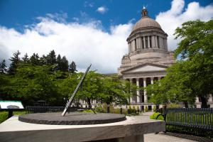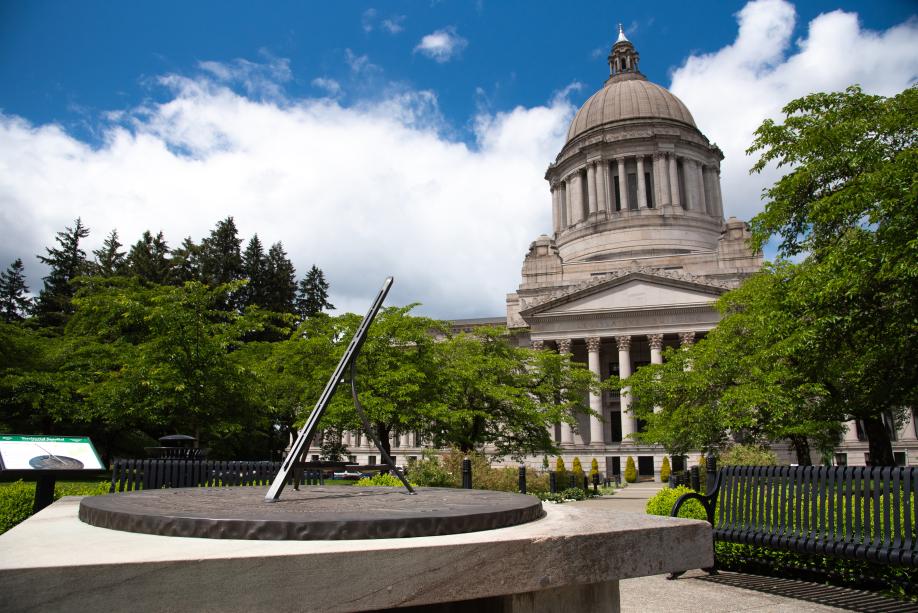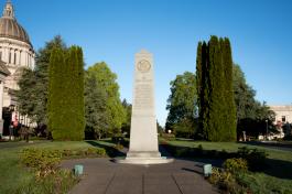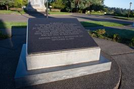
Territorial Sundial
In the late 1950s, when the State Library was constructed, a sundial was commissioned to sit north of the main entrance and be a focal point for the building.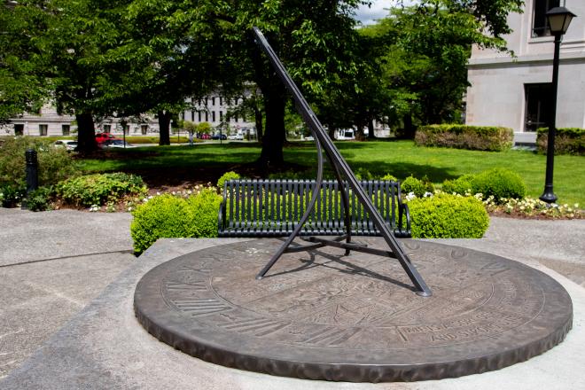
Facts
About the Territorial Sundial
John W. Elliot, a Seattle master craftsman who had created relief artwork for many public buildings in the state, was selected to design and build the Territorial Sundial.
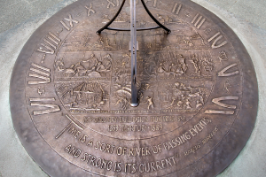
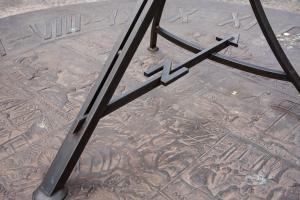
Relief style artwork projects from a flat background to give a three-dimensional effect. Bas-relief is a specific type of relief where images protrude from the surface very slightly. Elliot’s magnificent hand-hammered, bas-relief sundial is made out of brass and measures six feet across. The sundial rests on a large slab of Wilkenson sandstone, the same material that makes up State Library building facade. The gnomon, the object that casts a shadow to show the time, is made of bronze rods and features the letter “N” representing the northern direction.
Sundial panels
The surface of the brass sundial is divided into eight panels depicting important milestones in Washington state's territorial history. This historical theme can also be seen in the quote by Marcus Aurelius inscribed on the piece: “Time is a sort of river passing events, and strong is its current.”
Panel one
This panel represents the discoveries of Captain George Vancouver in 1792. Vancouver’s group was one of the first to explore and chart Puget Sound, named after Peter Puget, one of the group members. The captain also named many other important geographical landmarks in the area, including Mount Rainer and Vashon Island.
Panel two
This panel depicts Fort Okanogan's establishment in 1811. The Fort was built by John Jacob Astor’s Pacific Fur Company near the mouth of the Okanogan River in present-day central Washington and was used as a fur trading post with Native Americans.
Panel three
This panel shows Fort Vancouver's construction on the north side of the Columbia River in 1825. The Hudson’s Bay Company constructed and used the building as their headquarters for many years.
Panel four
This panel depicts the Cowlitz Convention of 1851. At this meeting, northern residents advocated for dividing the land north and south of the Columbia River into two separate territories. A number of local pioneers, including Tumwater’s Michael T. Simmons, were influential in this important event.
Panel five
This panel displays a large group of pioneers forming a wagon train as they crossed Naches Pass in 1853. The group took this route as a shortcut to Puget Sound from the Yakima country, but quickly found the rough Cascade Mountain pass a huge barrier to their progress. Many of the settlers had to kill some of their oxen and lower their wagons down the steep cliffs with rawhide ropes.
Panel six
This panel shows the Medicine Creek Treaty between the United States and Puget Sound Native Americans in 1854. Isaac Stevens, Superintendent of Indian Affairs for the Washington Territory, drew up the treaty, which required Native Americans to give up their lands and live in areas set aside for them. Under the treaty, they were to be paid for the land they turned over, their rights to fish and hunt in specified areas were to be protected, and medical and other such services were to be provided by the U.S. government. In return, the Native Americans were required to free their slaves, rid their communities of alcohol, and avoid trade across the Canadian border.
Panel seven
This panel depicts the first water-powered sawmill in Washington. Built in 1828 by the Hudson’s Bay Company roughly five miles east of Fort Vancouver, the mill was the first commercialization of lumber in the territory.
Panel eight
This panel represents the first railroad connecting to Puget Sound, built by the Northern Pacific Company in 1883. To the surprise and disappointment of Seattle and Olympia residents, Northern Pacific chose Tacoma as the outlet for this transcontinental line, which was a very small sawmill town at the time.