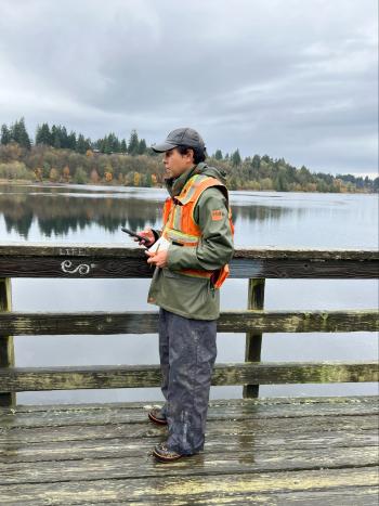
DES collecting data in, around Capitol Lake this week

Data will inform Deschutes Estuary project.
Visitors to Capitol Lake and the surrounding parks the week of Nov. 11 may notice biologists working along shorelines to collect data for the design of a restored Deschutes Estuary. The pedestrian path around Deschutes Parkway and Capitol Lake will remain open.
From Nov. 11-15, DES contractors will identify the boundaries of wetlands in and around the lake. The data will also help assess the state of the vegetation and habitat around the lakeshore. This work is called a critical areas assessment and includes collecting small soil samples.
The crew will work on foot near 5th Avenue and along the shoreline in Percival Cove, Interpretive Center Park, Tumwater Historical Park, Marathon Park, Heritage Park, and Deschutes Parkway.
DES is in the early design stages of restoring Capitol Lake to an estuary, which will improve water quality, wildlife conditions, and the community’s access to the waterway. It will also improve downtown Olympia’s resilience against flooding. The crew’s findings will help DES move estuary restoration to the next stage of design and will provide some of the information needed to apply for project permits. DES expects design work to continue through at least the end of 2026.
DES is partnering with Floyd | Snider and Environmental Science Associates (ESA) of Seattle on this work.
Learn more about the Deschutes Estuary project and subscribe to the project newsletter: DeschutesEstuaryProject.org.

